As COVID-19 spreads, what can big data do? During the epidemic, how can transportation authorities cooperate with relevant departments to comprehensively and efficiently control all kinds of transportation vehicles and facilities? How can citizens travel in an informed and secure manner?
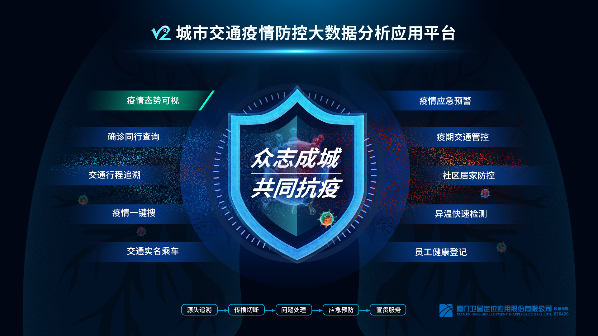
To meet the requirements of joint prevention and control of the epidemic, Xiamen GNSS, relying on its experience in intelligent and information technology of transportation, innovates and integrates BeiDou/GPS, thermal imaging temperature measurement, video image recognition, IoT, AI, and big data, based on the data acquisition and analysis of buses, taxis and online taxis, tourist bus, ships, intersections, residentials, etc., provides the government with rapid monitoring and early warning, diversion tracking, comparative inquiry, and other services for vehicles, hubs, supplies and identifies people with abnormal temperature, and provides the public with services of query of patients on the same vehicle, real-name query, early warning, and travel guidance. It builds a full-cycle, cross-departmental, multi-scene integrated epidemic control solution with the "source tracking - transmission breaking - problem handling - emergency prevention - publicity and implementation service" featured "traffic big data + epidemic prevention and control".
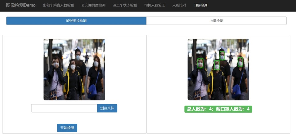
Using AI technology to identify people with abnormal temperature and whether people are wearing masks
The traditional manual method of detection on vehicles and transportation hubs requires a lot of manpower and material resources, because it is the hardest hit area of the epidemic. Moreover, it reduces passage efficiency and enhance the risk of cross-infection. The rapid detection system for personnel with abnormal temperature in transportation hubs and designated areas combines "thermal imaging + face recognition + artificial intelligence" technology. Detection and early-warning of abnormal body temperature without contact can be realized through the deployment of thermal body camera and background early-warning software. With an accuracy of ±0.3℃, it can detect people with abnormal temperatures and conduct tracking analysis through face recognition technology. In addition, the product also supports the identification and notification of whether the person is wearing a mask.

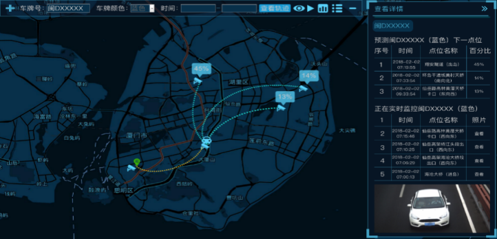
Efficiently track the vehicles with accurate positioning and rapid correlation
The outbreak occurred during the Spring Festival holiday when a large number of vehicles moved into and out of urban and rural areas, putting great pressure on traffic control. The epidemic emergency warning system can carry out real-time monitoring and track checking of all kinds of transportation vehicles such as buses, taxis, online taxis, passenger vehicles, private cars, passenger boats, etc. Meanwhile, it can carry out early warning and tracking control of vehicles entering the epidemic areas, so as to achieve effective and multi-level prevention and control.
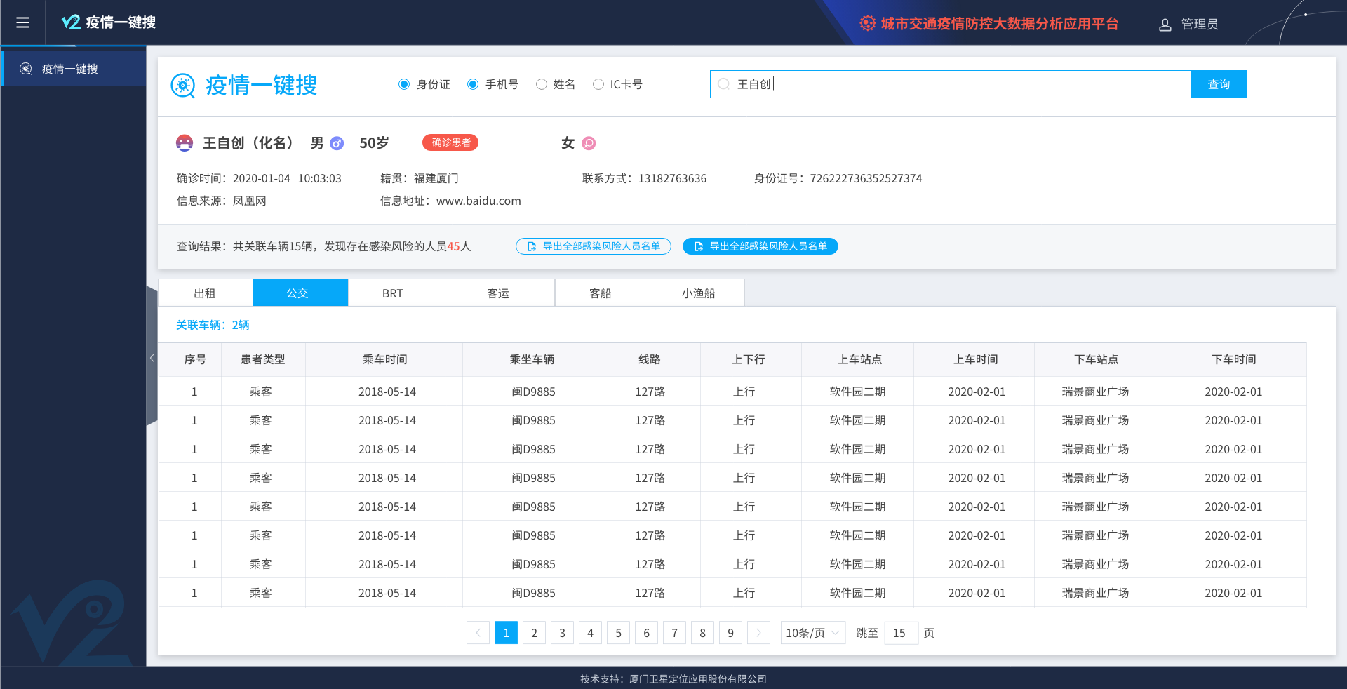
For a large number of traveling people, the platform obtained real-time monitoring data of the temperature measuring system and the data officially released by the prevention and control headquarters, and provides passengers with a channel for real-name registration when they take a taxi or a bus. The two-way information associates public travel trajectories of confirmed, suspected, and thermally abnormal persons on land and sea transport to facilitate the Joint Department of Epidemic Prevention and Control to search and locate related personnel in batches to achieve
better results in epidemic prevention and control.

Show the overall situation of the epidemic and ensure scientific decision-making
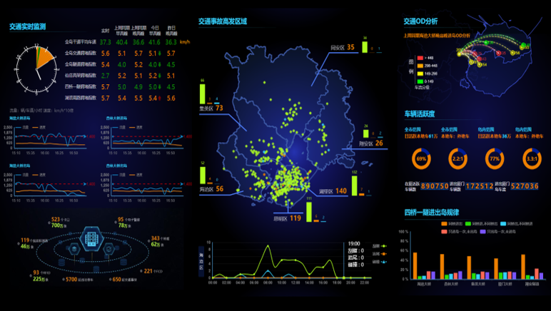
The epidemic data resource center integrates, processes, stores, and manages the complicated epidemic data and traffic data obtained through layers and presents a multi-dimensional way on the "epidemic situation map". The management department can intuitively obtain real-time epidemic data, regional epidemic trend, places of stay of infected people, distribution of the epidemic in transportation, and the proportion of travel vehicles for returning people, which can effectively support scientific decision-making in epidemic prevention and control.

With the support of epidemic information, traffic management departments can not only locate targets in the discovery stage, but also carry out targeted control and prediction in the epidemic development and control stage. For example, it provides emergency transportation support for the epidemic, unmanned logistics management in transportation hubs such as airports, and disinfection and monitoring of various vehicles. When resuming work, the vehicle inspection information of each highway intersection and other important intersections can be collected. Combined with the information of airport flight, railway, and passenger, the traffic congestion caused by the epidemic inspection can be analyzed with the help of big data technology, providing support for the traffic management department in diversion, evacuation, and staggering peak traffic control.
Upgraded query method reassures the public travel
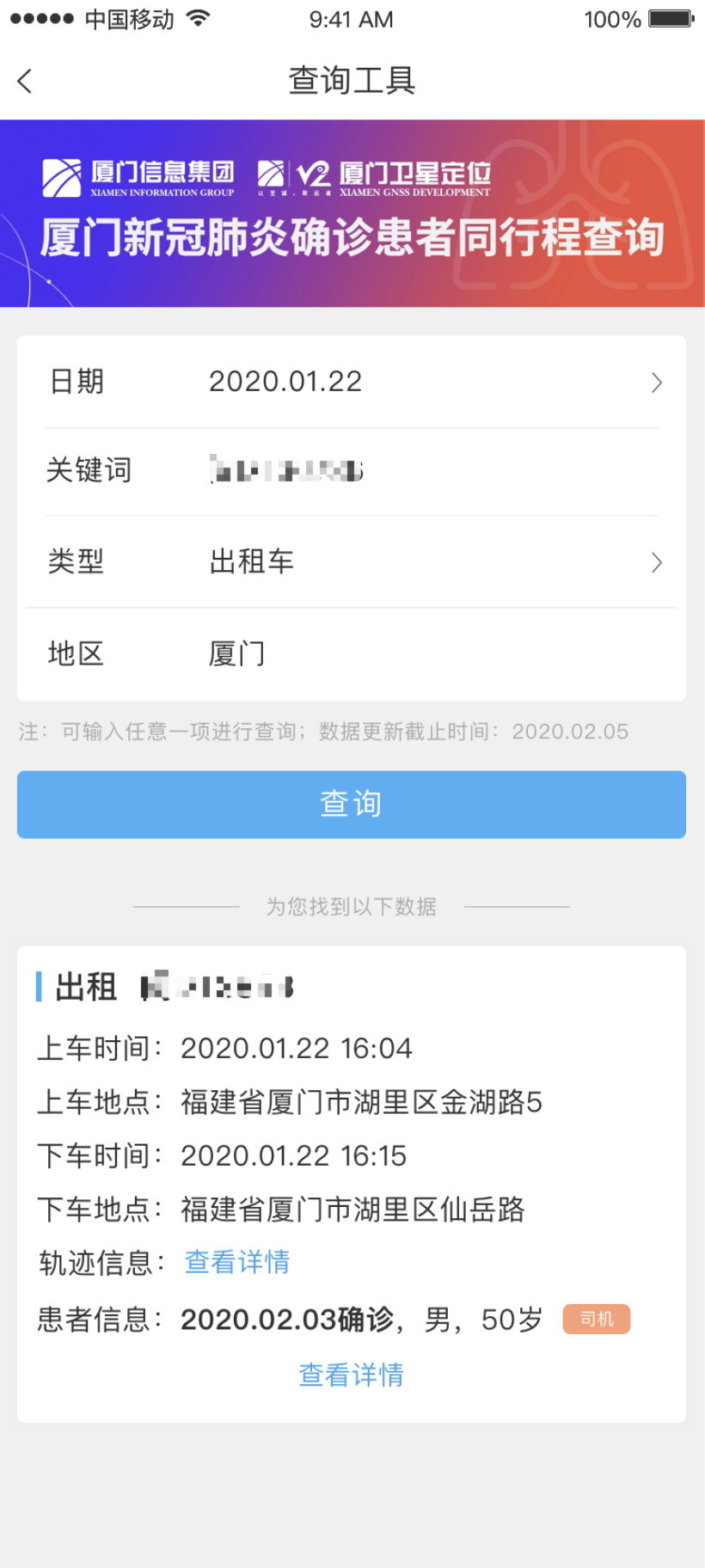
Traveling on public transport during the epidemic often causes apprehension. In the upgraded version of the confirmed peer travelers query system supported by Xiamen GNSS, public can check the epidemic cases on the taxi, bus /BRT, tourist bus they have taken with the information of the route, time, and e-card number. Thus, travelers can clearly grasp the train number carrying the confirmed patient from the incubation period to diagnosis, as well as the detailed boarding time/place, getting-off time/places, driving track, etc., to evaluate the risk of infection.
 No man is an island in the face of adversity. Xiamen GNSS will take the epidemic prevention and control work as its own responsibility, and work with relevant departments and partners to win the battle against epidemic.
 NewsTimely and actively release the company updates, tell the enterprising stories of Xiamen GNSS staff, spread the voice of the enterprise, transmit its positive energy, establish its good image, and improve its communication power and influence.
 ServicesAdher to the "customer-centered, quality first" business philosophy, always provide customers with professional, high quality, efficient services and a wealth of information products, meet the needs of our customers, and win their trust.
 About UsXiamen GNSS Development & Application Co., Ltd. is a member of Xiamen Information Group, which was established in 2001 and landed on the New OTC Market in 2017 (stock name: GNSS, stock code: 870420). Based on the advantage of Beidou high-precision location information service, the company has been committed to the development, construction, and operation services of land and marine transportation cloud platforms. It provides industry-leading application software products and overall solutions in the transportation fields including urban bus, taxi, passenger and freight transportation, as well as in public security, traffic police, border inspection, marine, port and shipping, and law enforcement. Meanwhile, the company actively promotes the innovative application of "Beidou+" and satellite Internet in China, ASEAN, and "Belt and Road" countries.


 No man is an island in the face of adversity. Xiamen GNSS will take the epidemic prevention and control work as its own responsibility, and work with relevant departments and partners to win the battle against epidemic.
 Products and Solutions
 TEL
TEL